Introduction
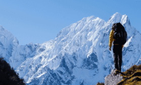
The Manaslu Circuit Trek is a journey through a land of natural beauty and cultural heritage. Located in the Himalayas in Nepal, the Manaslu region provides trekkers with stunning mountain views, varied landscapes, and secluded villages. Before starting this incredible adventure, it is necessary to have a good insight into the Manaslu trek map. This precise guide will explore the complexities of the map, focusing on significant attractions, essential routes, and notable landmarks throughout the trek.
Map Overview
The Manaslu trek map is a gateway to adventure, offering trekkers an opportunity to explore the pristine beauty of the Nepalese Himalayas and immerse themselves in the rich culture and traditions of the region. By understanding the layout of the map, identifying points of interest, and selecting essential routes, trekkers can embark on a journey of a lifetime, filled with unforgettable experiences and breathtaking landscapes.
Embarking on the Manaslu Trek is a journey into the heart of the Himalayas, where rugged landscapes and towering peaks await. But before setting foot on this iconic trail, it’s essential to understand the terrain and plan your route accordingly. In this comprehensive guide, we’ll delve into the intricacies of the Manaslu Trek map, offering insights and tips to ensure a smooth and unforgettable adventure.
Understanding the Manaslu Trek Map
Before starting the trek, become familiar with the layout of the Manaslu summit. The trek usually begins in Soti Khola and follows a circular path around Mount Manaslu, the eighth-highest mountain globally. During the journey, hikers will encounter various terrain, like dense forests, challenging landscapes, high mountain passes, and hidden villages where the local indigenous people live.
Why do we need a trek map?
-
- Exploration: To explore the significance of the Manaslu Trek map in planning.
-
- Provides guidance: A trek map provides a navigational tool, guiding trekkers along the designated route and helping them stay on track.
-
- Ensures safety: By highlighting key landmarks, trails, and waypoints, a trek map helps trekkers avoid getting lost in unfamiliar terrain, minimizing the risk of accidents or emergencies.
-
- Offers route planning: Trekkers can use the map to plan their route, including rest stops, overnight stays, and points of interest to optimize their trekking experience.
-
- Enhances orientation: With a map, trekkers can better orient themselves within the surrounding landscape, identifying natural features and landmarks to aid navigation.
-
- Provides context: A trekking map offers helpful context about the geographical and topographical attributes of the area, allowing trekkers to understand the terrain they’ll be traveling and anticipate challenges or barriers.
-
- Enables communication: The Map allows trekkers to communicate their location and itinerary effectively with guides, fellow trekkers, and emergency services if needed, facilitating coordination and assistance when required.
Understanding the Manaslu Trek Route
-
- Overview of the Manaslu Circuit Trek, including its length, difficulty level, and highlights.
-
- A description of the trail from Soti Khola to Larkya La Pass and beyond.
-
- Familiarize yourself with the route to navigate safely through various landscapes and altitudes.
-
- Key Points of Interest Along the Trek:
-
- Highlight noteworthy landmarks and attractions along the Manaslu Trek, such as traditional villages, Buddhist monasteries, and stunning mountain vistas.
-
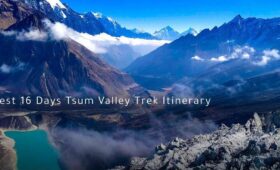
- Explore side trips and optional detours to hidden gems like Tsum Valley, known for its cultural richness and picturesque beauty.
-
- Emphasizing the significance of consulting the Manaslu Trek map to determine points of interest and plan rest stops or overnight stays accordingly.
-
- Topographic Features and Altitude Profiles:
-
- Analyze the topographic features of the Manaslu region, including valleys, ridges, and high mountain passes.
-
- Provide altitude profiles of the trek to anticipate elevation gains and acclimatization challenges.
-
- Navigation Tools and Resources:
-
- Learn about different navigation tools for trekkers, including GPS devices, mobile apps, and paper maps.
-
- Know the importance of carrying a reliable Manaslu Trek map and familiarizing oneself with route markers, signposts, and local landmarks.
-
- Safety Considerations and Emergency Preparedness:
-
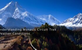
- Discuss safety considerations for trekking in remote jungle areas, including the risk of floods, landslides, and stormy weather.
-
- Provide guidelines for emergency preparation, such as carrying essential supplies, communication devices, and first aid kits.
-
- Encourage trekkers to register with local authorities or trekking agencies and share their itinerary with a trusted connection before embarking on the Manaslu Trek.
Understanding the Manaslu Trek map is essential in planning a rewarding trekking adventure in the Himalayas. By enlightening themselves with the route, significant landmarks, topographic features, and navigation tools, trekkers can confidently undertake their journey and fully appreciate the stunning landscapes of the Manaslu region.
What Makes the Manaslu Trek Map Essential?
-
- Exploration of the Manaslu Trek map in planning and executing a successful trekking adventure.
-
- Trekkers need to rely on detailed maps to guide the rugged terrain and various topography of the Manaslu region.
-
- Proper guidance throughout the journey to decide the stops and venture again as per the planned itinerary
FAQs
What is the significance of a detailed map for the Manaslu Trek?
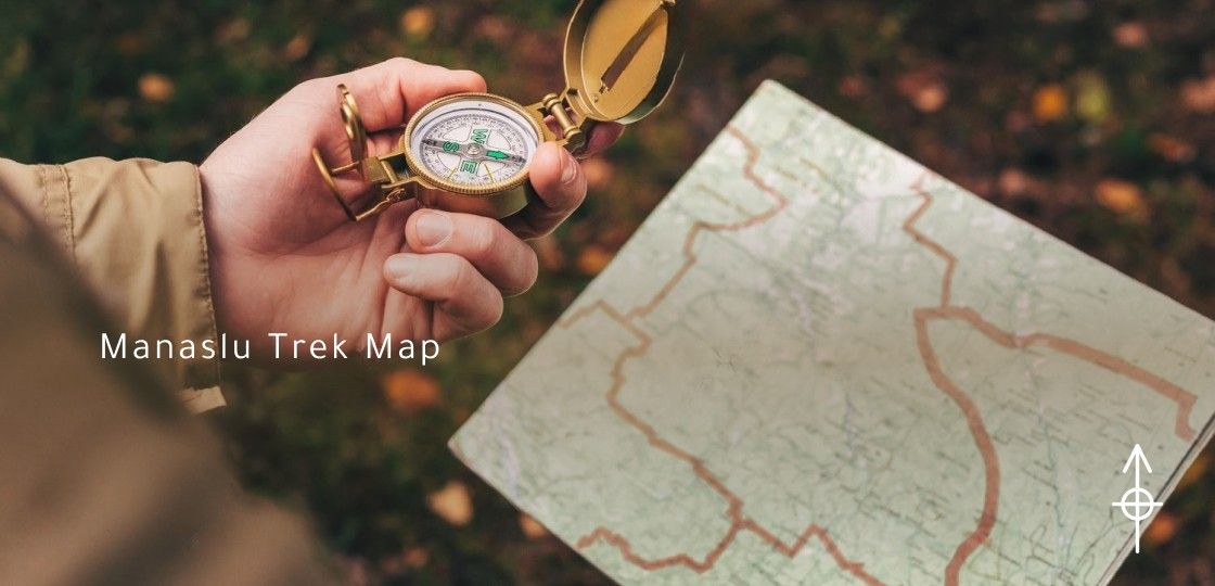
Having a detailed map is necessary when it comes to planning and navigating the Manaslu Trek. It offers valuable information about the trekking route, trails, villages, landmarks, altitudes, and potential side trips, guaranteeing a secure and pleasant journey.
What facts does a detailed map of the Manaslu Trek include?
A comprehensive map usually shows the hiking trail from beginning to end, including meaningful landmarks like villages, teahouses, viewpoints, monasteries, rivers, bridges, and high mountain passes. It may also provide information on altitude profiles, distances between locations, and possible dangers.
Where can I find a detailed map of the Manaslu Trek?
Various sources, such as trekking guidebooks, travel agencies, online platforms, local stores in Kathmandu, and trekking hubs like Pokhara, offer detailed maps of the Manaslu Trek. Before beginning the trek, our team will provide you with a detailed map that you can also access on our website.
What are the advantages of using a detailed map during the Manaslu Trek?
Using a detailed map enhances navigation and orientation on the trail, helping trekkers stay on course and avoid getting lost. It also allows trekkers to plan their daily routes, estimate distances and travel times, and identify points of interest.
Can I rely solely on a detailed map for navigation during the Manaslu Trek?
Although a detailed map is crucial, it is advisable to complement it with additional navigation aids like guidebooks, GPS devices, and advice from experienced guides or fellow trekkers. Trekkers should also be ready for unpredictable weather conditions and trail changes in navigation.
Are there any specific safety precautions to follow when using a detailed map on the Manaslu Trek?
To withstand the challenges, trekkers must have a waterproof and sturdy map. It is crucial to keep the map accessible, protect it from harm, and regularly update it with any new information or changes obtained during the trek. Moreover, trekkers should possess proficient map reading and orienteering skills to interpret the map.
Can I download digital maps of the Manaslu Trek for offline use?
Yes! You can easily download from various online platforms and mobile apps. Trekkers need convenient navigation tools even in areas with limited or no cellular network coverage.